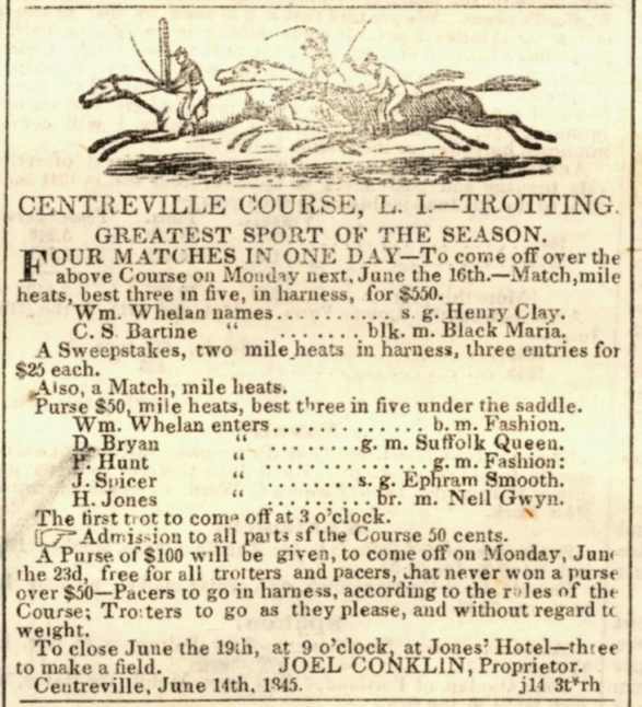
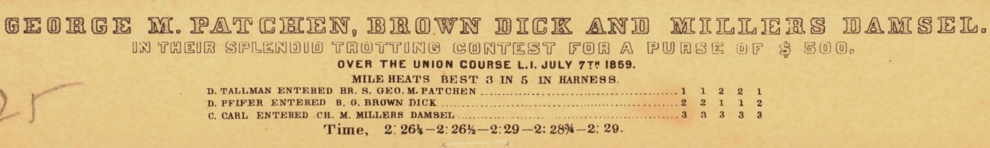
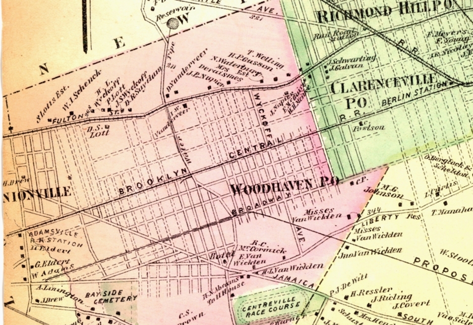
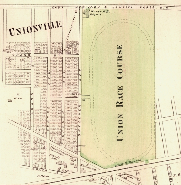
Later, Woodhaven became the site of two racetracks: the Union Course[7] (1821) and the Centerville (1825). There was a trotting course formed in 1825 at Centreville, a mile southeast
of the Union course.
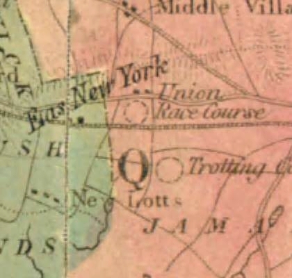
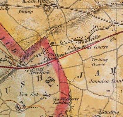
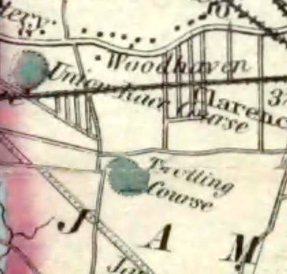
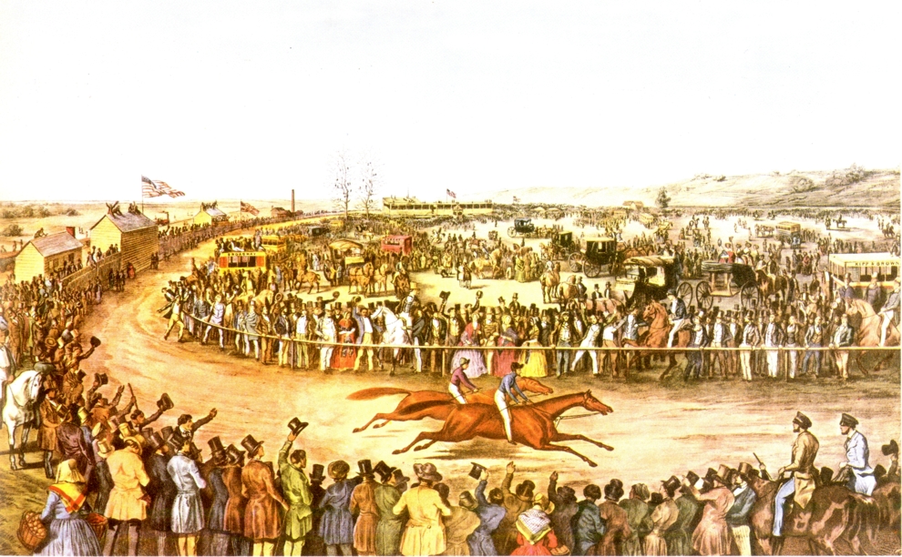
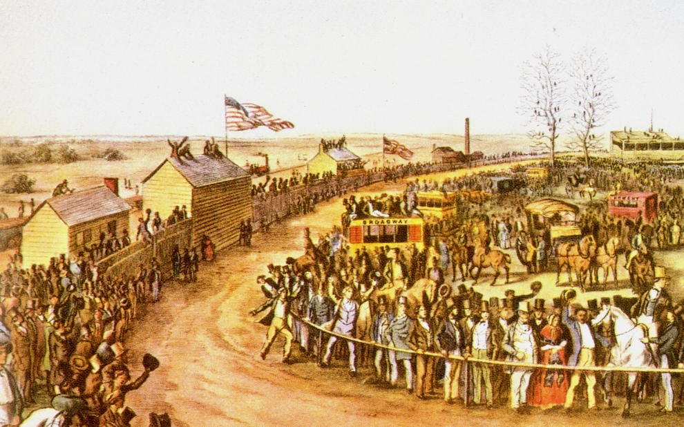
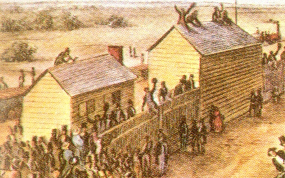
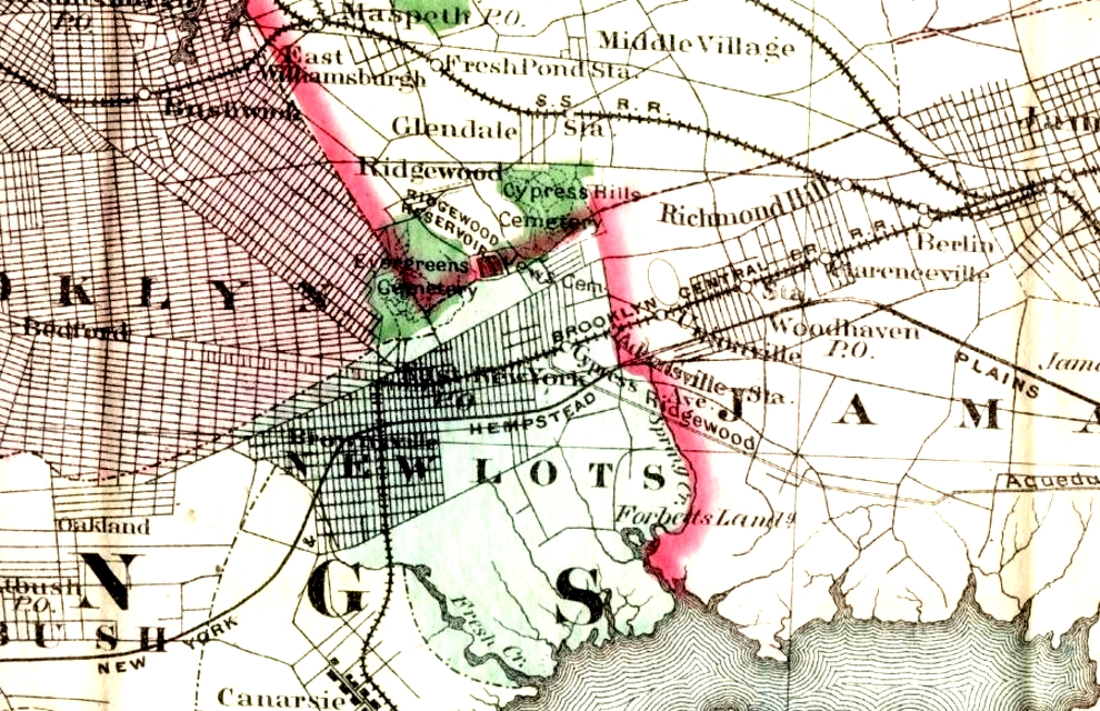
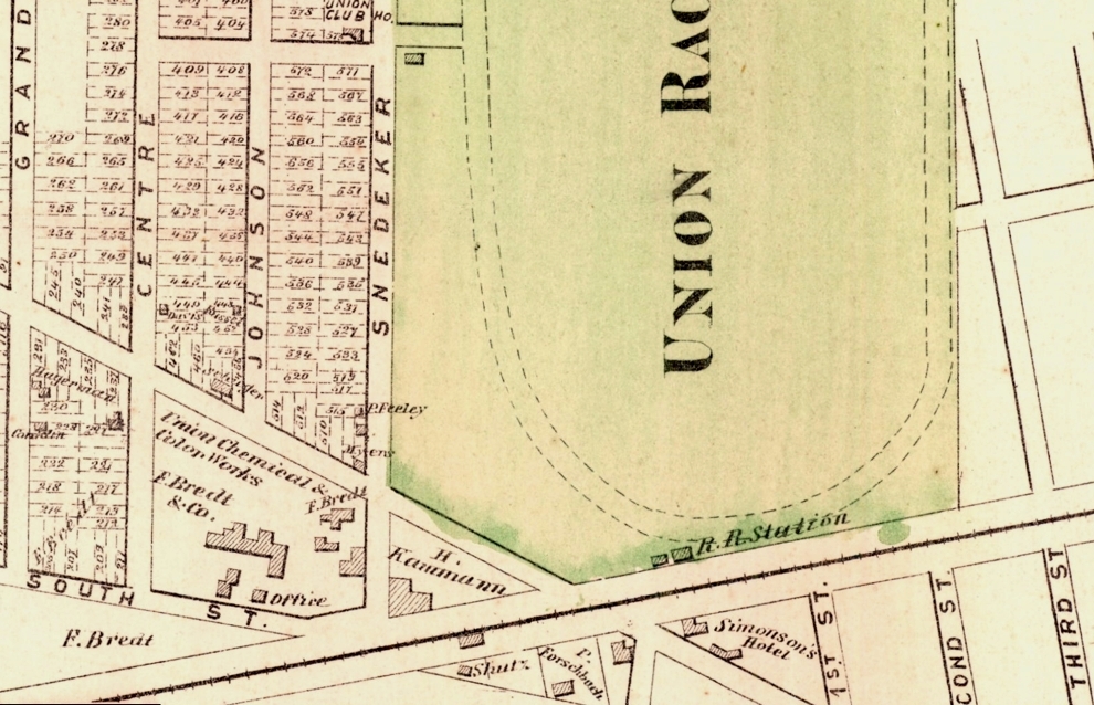
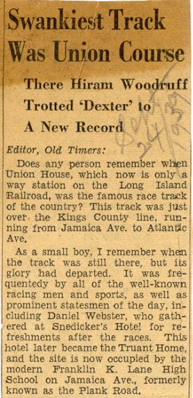
Union Course was a nationally famous racetrack situated in the area now bounded by 78th Street, 82nd Street, Jamaica Avenue and Atlantic Avenue. The Union Course was the site of the first skinned — or dirt — racing surface, a curious novelty at the time. These courses were originally without grandstands. The custom of conducting a single, four-mile (6 km) race consisting of as many heats as were necessary to determine a winner, gave way to programs consisting of several races. Match races[8] between horses from the South against those from the North drew crowds as high as 70,000. Several hotels (including the Snedeker Hotel[9] and the Forschback Inn) were built in the area to accommodate the racing crowds.
FROM THE NEW YORK AMERICAN APRIL 27, 1836
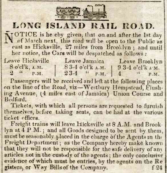
AS EARLY AS MARCH 1837 UNION COURSE IS SHOWN AS A STOP.
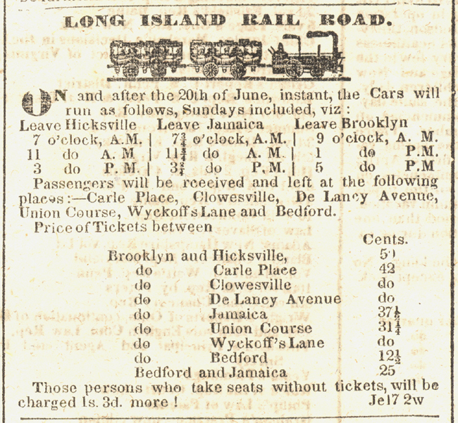
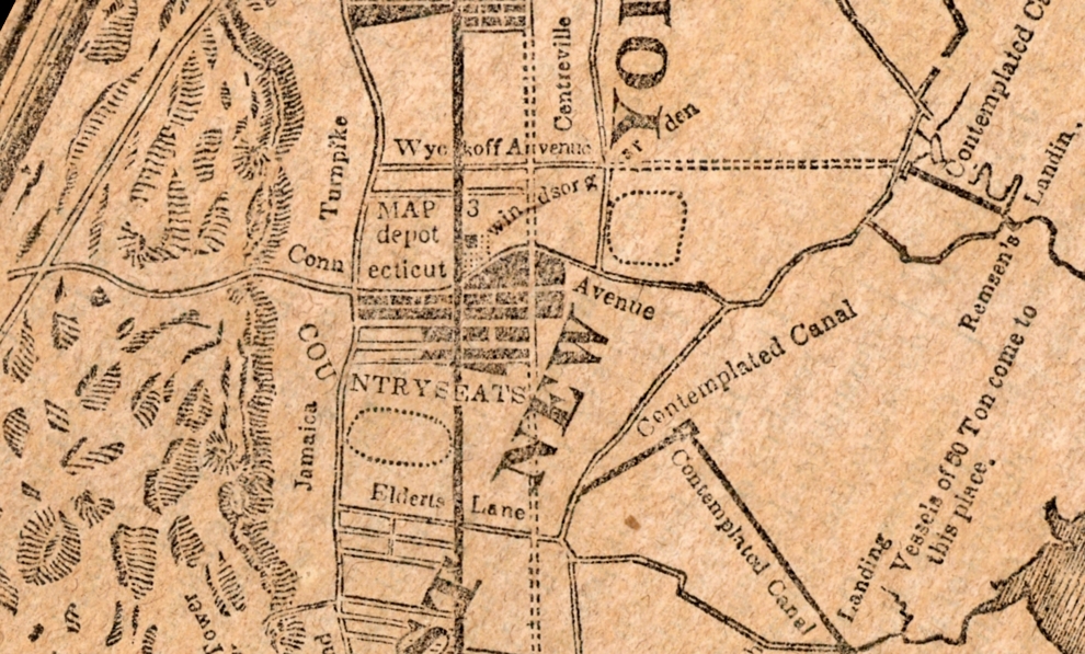
AS LATE AS JUNE 1837 UNION COURSE IS SHOWN AS IS "WYCKOFF'S LANE"
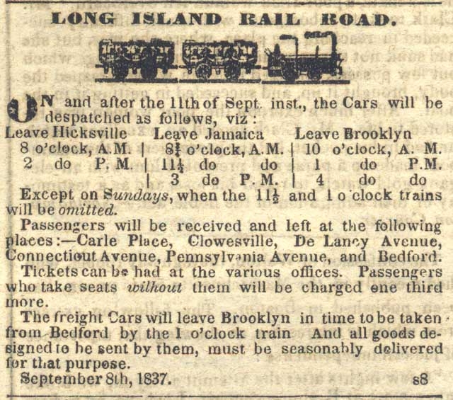
THIS SEPTEMBER 8, 1837 TIME TABLE SHOWS "PENNSYLVANIA AVENUE" - AND "CONNECTICUT AVENUE" INSTEAD OF UNION COURSE.
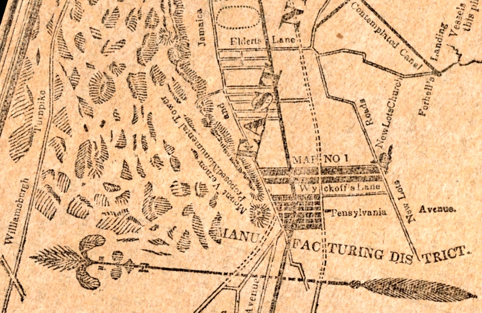
1953 RESEARCH BY EDNA HUNTINGTON, LONG ISLAND HISTORICAL SOCIETY LIBRARIAN, SHOWED THAT CONNECTICUT AVENUE BECAME WOODHAVEN BLVD.
ACTUALLY IT BECAME FLUSHING AVENUE, TROTTING COURSE LANE, WOODHAVEN AVENUE AND THEN WOODHAVEN BOULEVARD.
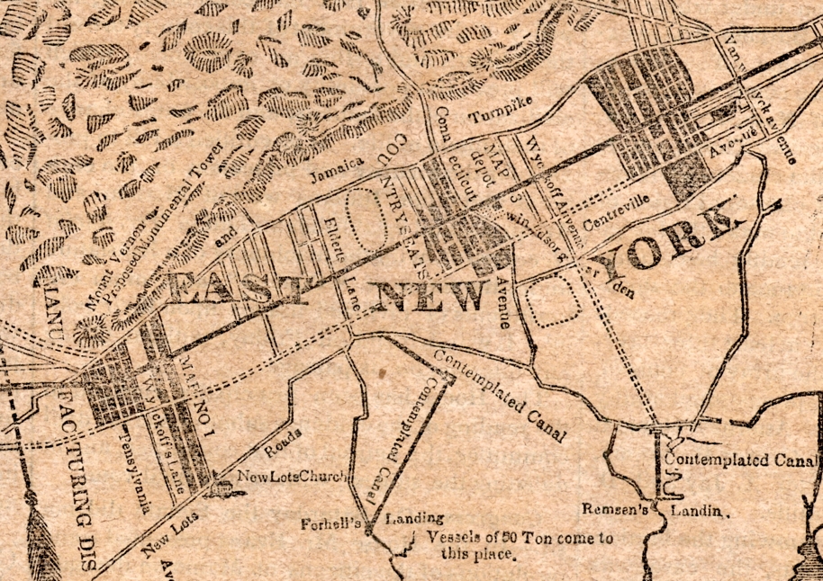
THE 1873 COLTON MAP SHOWS FLUSHING AVENUE
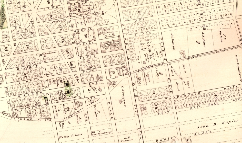
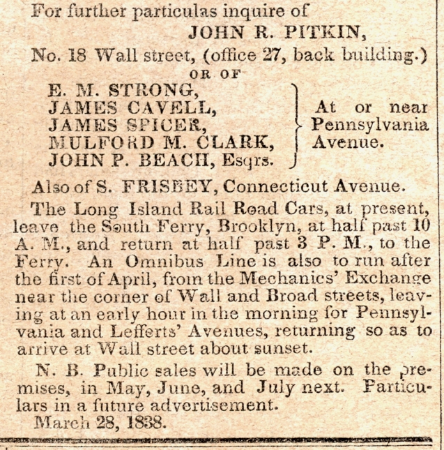
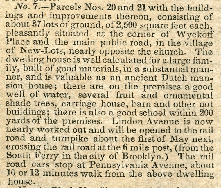
A MAY 5, 1838 AD BY JOHN R. PITKIN INCLUDED THIS MAP WHICH SHOWS WYCKOFF'S LANE, PENNSYLVANIA AVENUE AND CONNECTICUT AVENUE.
AND MENTIONS THE STATION AT PENNSYLVANIA AVENUE
THE HISTORY OF QUEENS COUNTY
with illustrations, Portraits & Sketches of Prominent Families and Individuals.
New York: W.W. Munsell & Co.; 1882. pp. 57-59 STATES:
After the passing of an act by the Legislature allowing of trials of speed in Queens
county for a term of years, during the months of May and October, horseracing was transferred to the Union course.
In 1834 the time was
extended for "years more, the racing to be between April 1st and June 5th and from
September 1st to November 5th yearly". This course, over a mile in circuit, was on a
level surface, with a nearly oval track. Connected with it was a jockey club of above
250 members, who contributed $20 each yearly to the "jockey club purses."
This course was afterward owned by the "Union Association," capital $100,000,
formed upon the act of the Legislature of August 2nd 1858.
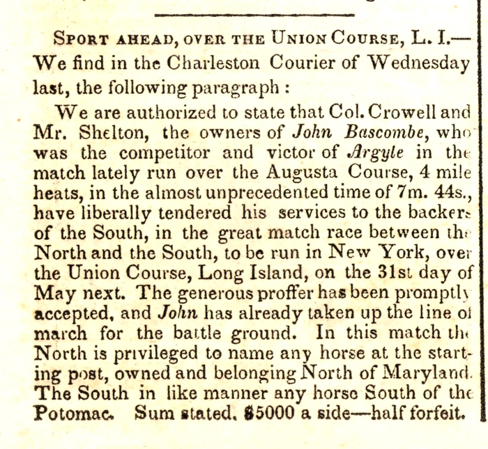
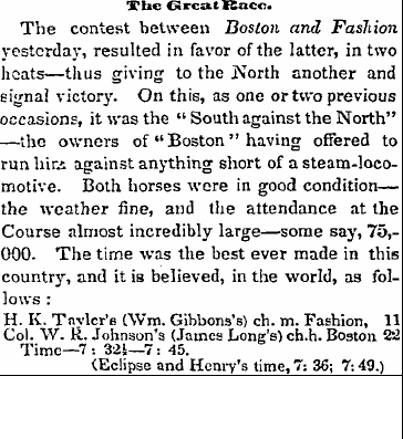
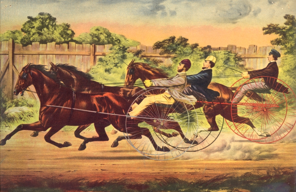
On May 10th 1842 there was another match for $20,000 a side on
this course, between the Virginia horse "Boston," 9 years old, and
carrying 126 pounds, and the New Jersey mare "Fashion," 5 years old,
and carrying 111 pounds. "Fashion" won in two heats. From fifty to
seventy thousand spectators were computed to be present, including a great many
ladies.
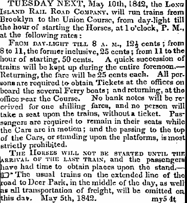
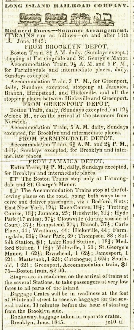
ON MAY 10, 1842 THERE WAS A BIG RACE AND VERY SPECIAL TRAIN SERVICE
"..... and the attendance at the Course almost incredibly large - some say, 75,000."